➀ [Old Photographs from the 1900s (circa 1900-1910)] → ➁ [AI Colorization] → ➂ [Reiwa Era, Spring 2019] → ➀ → ➁ → ➂ → ➀....
2. Things Depicted in the Old Photograph (Click to Open in a New Tab)
3. Explanation of This Old Photograph
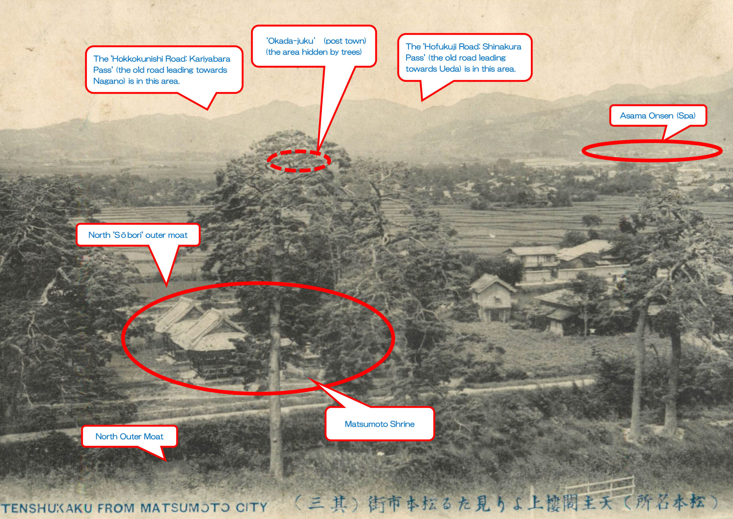
This old photograph is a postcard published around 1907 (Meiji 40).
Notably, the ‘Matsumoto Shrine’ was facing west.
It was renovated to the current south-facing shrine in 1913 (Taisho 2).
On the north side of ‘Matsumoto Shrine,’ you can see the 'Sōbori' outer moat before it was filled in 1932 (Showa 7).
Beyond that, rice fields spread out, and the area surrounded by the forest further ahead is the vicinity of ‘Okachimachi,’ where samurai residences once stood.
The image above indicates ‘Okada-juku (post town),’ ‘Kariyahara Pass,’ and ‘Shinakura Pass.’
Before the mid-Meiji era, the route split at ‘Okada-juku:’ the path over ‘Kariyahara Pass’ (Hokkokunishi Road) led toward Nagano, while the route over ‘Shinakura Pass’ (Hofukuji Road) was the main route toward Ueda.
After this photograph was taken, the north side of Matsumoto Castle saw rapid residential development, with the opening of the ‘Matsumoto Elementary and Higher School Tamachi Division’ in August 1910 (Meiji 43) and the ‘Matsumoto Municipal Hospital’ in 1927 (Showa 2).
In a modern photograph, you can see ‘Matsumoto Shrine’ and the courthouse across from the outer moat, with a residential area spreading out beyond them.
In the distance, you can see ‘Shinshu University Matsumoto Campus’ and the hotel district of ‘Asama Onsen (Spa).’
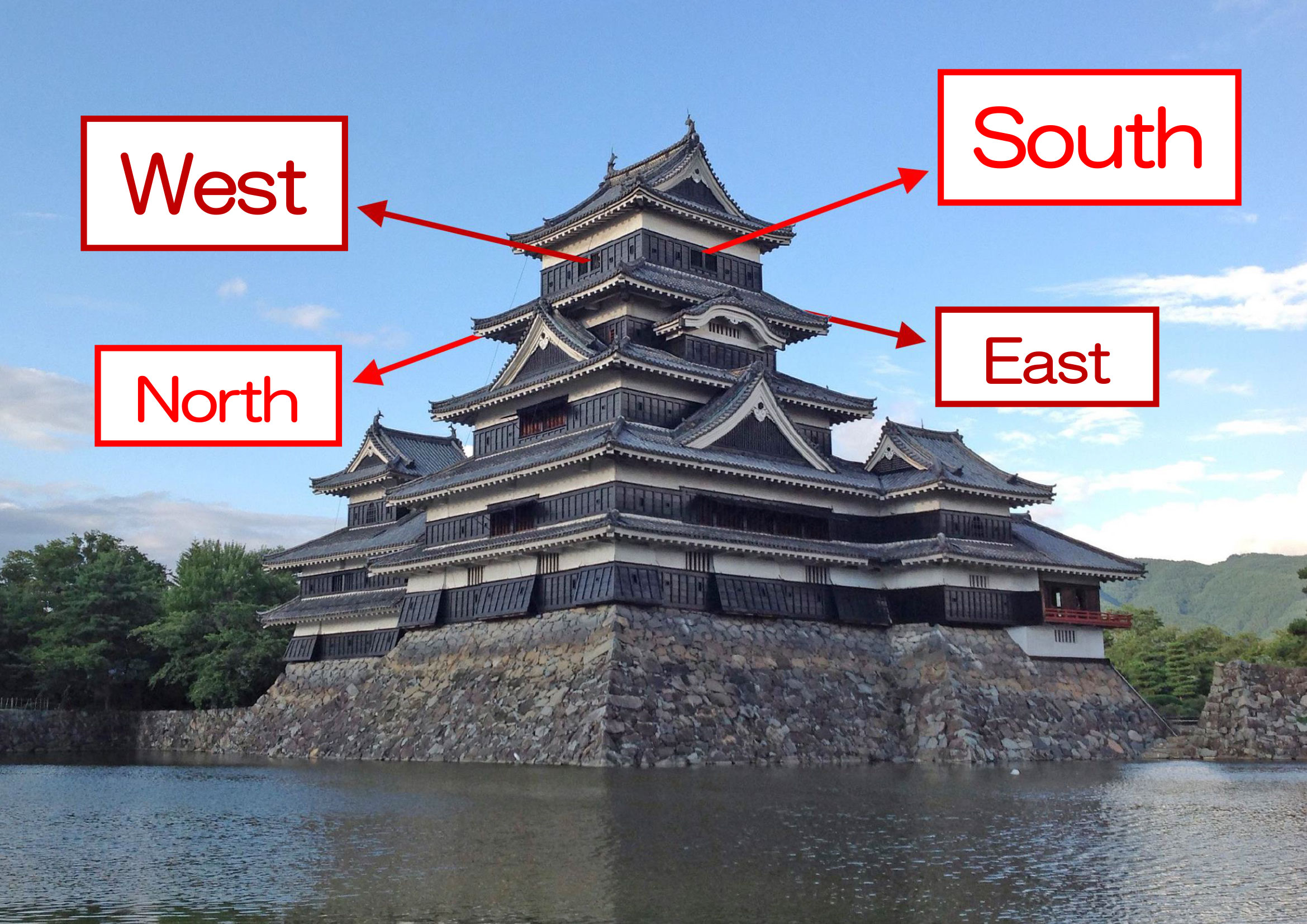
4. Links to Sites for "Other Directions"
・The View from the Tenshukaku of Matsumoto Castle: Past and Present [East]
・The View from the Tenshukaku of Matsumoto Castle: Past and Present [West]
・The View from the Tenshukaku of Matsumoto Castle: Past and Present [South]